
Trace a South Riding Street
South Riding is an unincorporated Census-designated place, so address research runs through Loudoun County systems rather than a city clerk. A whole-street result is a parcel inventory. It can identify parcels, legal descriptions, and recorded ownership evidence, but it does not create a household roster. Keep the exact number, suffix, and any condominium or section detail together. One delivery address can connect to a separate garage, parking, or common-element parcel.
- Search the Loudoun property roll with the street number and street field. If the first form fails, try the suffix omitted or the permitted wildcard, then save every returned parcel identifier.
- Open each selected parcel in WebLogis. Confirm the property address, subdivision, plat, and map context before treating two similar addresses as the same place.
- Compare the assessor's situs address with its tax mailing address. The second field is correspondence information, not automatic evidence of residence.
- Use the current grantee or an instrument reference in PAX to find the recorded conveyance. Verify the match through the lot, section, plat, or legal description.
- Check permits by address or PIN when a construction date or project history matters. For older address clues, use the regional criss-cross directory run only as a lead.
That sequence makes the record role clear at each step. Parcel data describes land and assessment; deeds describe an instrument; permits describe work; a directory or voter product has separate access limits. It also avoids assuming that a mail recipient, an owner, and an occupant are the same person.
South Riding Parcel Fields
The Loudoun real-property search has visible fields for Parcel ID, Land Use Code, Street #, a street selector, Street, and ZIP Code. It also offers Property Address, Tax Map Number, Combined Search, Advanced Search, sorting, and results-per-page controls. Parcel IDs are 12 characters, an asterisk works as a wildcard, and street suffixes may be left off. Advanced Search is the place for ranges such as year built or stories.
| South Riding search field | Input type | Use | Important limit |
|---|---|---|---|
| Street # and Street | Standard fields | Find parcel matches by address | Keep the unit and suffix in notes |
| ZIP Code | Standard field | Narrow parcel/property matches | It is not a resident list |
| Parcel ID | 12-character identifier | Return one known parcel | Related parking or garage parcels can be separate |
| Tax Map Number | Property field | Match map and assessment references | Confirm against the legal description |
| Advanced Search | Optional filters | Use story, tax-map, or year-built ranges | Do not infer an occupant from a building field |
The property result can show an owner or taxpayer, mailing and property addresses, legal description, tax district, subdivision, parcel data, acreage, building characteristics, land-use class, values, sales, and deed references. The county describes these as public property information and updates the data weekly. Owner-name searching is documented in WebLogis help as internal only, so a public name search should not be assumed.
WebLogis for South Riding Streets
Loudoun WebLogis supplies the map layer that turns a street result into a parcel context. Enter a house number and choose an autocomplete street address, then use Locate on Map. A map click can return Parcel and Platfile Info. The documented land-record layers include address points, road centerlines, parcel boundaries, subdivisions, ZIP Codes, and a master address list, along with zoning and environmental overlays.
WebLogis also accepts a nine- or twelve-digit PIN or a three-digit map tile. Some searches reduce a twelve-digit PIN to its first nine digits, so retain the displayed PIN as well as the search value. Find Adjoining Parcels highlights immediate parcel neighbors and lists PINs. A distance search is capped at 5,280 feet, and maps with more than 50 returned parcels do not label each one individually.
A WebLogis parcel-viewer screen shows the practical starting point for a South Riding address search.
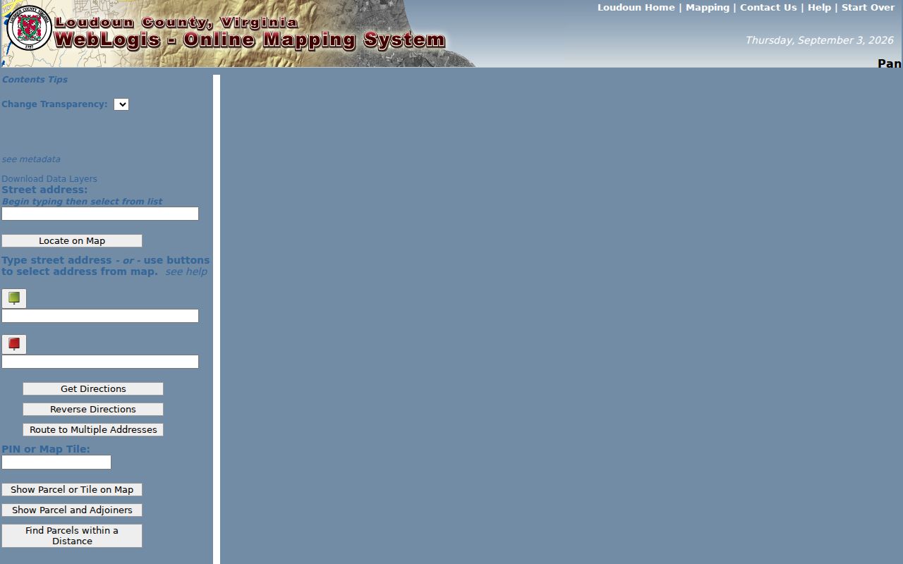
Use the viewer to record the address, PIN, parcel boundary, and displayed subdivision before moving to an assessment or land-record result.
South Riding Street Plat Clues
A plat translates a street address into a lot, block, section, or subdivision reference. That reference is often steadier than the visible postal place. An official South Riding sample at 42806 Pilgrim Sq shows subdivision SOUTH RIDING, plat 2000-0161, plat title SOUTH RIDING SECTION 51, project SBRD-2000-0023, and parent references. Other county samples at Elk Lick Road and Riding Center Drive show different plat and project identifiers.
- Parcel or PIN
- A county identifier for a mapped property. It can connect assessment, mapping, and recorded-land searches, but it is not a person identifier.
- Situs address
- The physical property address shown by the assessor. It is different from a tax mailing address.
- Plat
- A recorded map that can show a subdivision, lot, section, roads, and parcel geometry.
- Criss-cross directory
- An address-first directory that may lead to a subscriber or occupant entry for the particular volume and year.
Record the plat number, title, subdivision, section, project number, and parent PIN with the street address. A parent identifier can matter for a condominium unit, garage, parking space, or common element. It shows a property relationship, not a resident relationship.
South Riding Street Record Sets
Each address-keyed source answers a different question. For a South Riding street directory search, identify the source and date for each field instead of merging them into one personal profile. The table separates the county tools and the kind of evidence each can provide.
| Address-keyed source | Custodian | What a record can show | Access route |
|---|---|---|---|
| Assessor parcel | Commissioner of Revenue | Owner/taxpayer, mailing and situs addresses, legal description, value, and building details | Free public search, updated weekly |
| GIS parcel map | Loudoun GIS | PIN, boundary, subdivision, plat, zoning, overlays, and adjoiners | Free map viewer; owner-address route is internal only |
| Deed index and image | Circuit Clerk | Parties, recording date, instrument, book/page, consideration, and legal description | Index with account; images paid or kiosk access |
| Plat | Circuit Clerk and GIS | Lot, section, road, subdivision, and parcel geometry | PAX, historical viewer, or GIS; series coverage varies |
| Permit | Building and Development | Permit, address, PIN, issue date, project, and type | LandMARC or permit GIS; inquiry form for help |
| Historic directory | LOC and local holdings | Address-to-subscriber or occupant leads for a particular volume | Collection or onsite access; no verified South Riding entry |
Virginia voter products are not included as a public street roster. The public voter portal serves an individual status workflow, while list products are controlled under state law and include protected-voter limits. The official voter-list request form shows why a street-wide result should never be promised from that system.
PAX Deeds Along South Riding Streets
Once the parcel is confirmed, use PAX, the Circuit Clerk's land-record system, to look for the recorded trail. For a South Riding parcel, search the current owner as grantee or use an instrument reference, then capture the grantor, grantee, recording date, instrument ID, book/page, document type, consideration, cross-reference, and legal description. Search the seller as an earlier grantee and verify every link by lot, plat, or legal description, not by surname alone.
Deed-book indexes reach 1956 to the present and deed images reach 1969 to the present. Historical viewers have series-specific coverage back to county formation, so a missing online image does not mean a legal record is absent. Plats have image coverage from 1990 forward and a viewer for 1946 through 1989. A deed of trust is financing evidence, a release is not a sale, and a plat does not transfer ownership.
The county's remote land-record access added occasional-user searching in September 2025, with free index access and paid image purchase or download. Public kiosks remain an alternative for image access. That change is useful for a South Riding address, but the series coverage and document type still determine what can be found online.
South Riding Street Permits
LandMARC provides public permit and land-application searching without an account, although an account is needed to submit an application. The historic issued-residential-permit GIS layer begins in 2010 and runs through the prior year. Its fields can include permit number, PIN, issue month and year, street address, unit type, subdivision or project, zoning, ZIP, and planning or election context.
Permit data can help date construction or later work. It cannot establish who occupied a property. For a single property question, the county's permit inquiry accepts one property address, a permit number, optional attachments, and a summary, with a two-business-day target response. For a street-wide scan, the public GIS layer is the better fit because it preserves the address, PIN, project, and issue-year fields.
A LandMARC search screen documents the county's permit and land-application entry point.
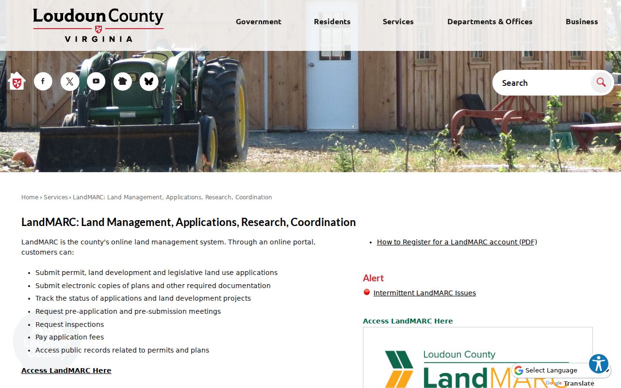
Match a permit result to the PIN and the plat context before using it as an address-history clue.
South Riding Address Names
South Riding can appear under more than one place presentation. USPS lists South Riding 20152-5926, the association presents South Riding VA 20152, and sampled county parcel cards show CHANTILLY VA 20152 in the Town Zip field. A failed South Riding street search is a reason to retry Chantilly with the same five-digit ZIP, then compare the USPS delivery-point result and the county parcel.
Do not assume a city-style street grid. No official source located a distinct South Riding grid, a street-renumbering year, or an annexation narrative. The reliable continuity tools are the county road-centerline and address-point layers, a subdivision plat, a PIN, and the legal description. South Riding sections, Amberlea, Lakeside, and Reserve can also be useful search terms, but they are distinct association or subdivision contexts.
A WebLogis search-help page illustrates the address, PIN, adjoiner, and map options behind this South Riding street-directory method.
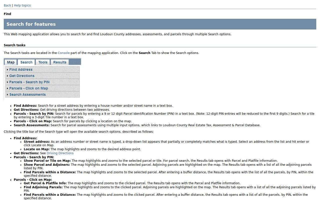
Keep the postal form, parcel Town Zip, street suffix, unit, section, and PIN in the same research note so a place-name mismatch remains visible.
South Riding Street History
The Library of Congress guide identifies a Loudoun and Fauquier criss-cross run for 1987 through 1996. Search the address column first, record the spelling and the volume's key, then move to the name section. South Riding's planned development largely postdates that run, so it is more likely to help with predecessor rural or nearby addresses than with a current section. No official South Riding-specific directory entry or publisher run was located.
County record history is deeper than the modern community name. Loudoun formed in 1757, and its Historic Records collection reports that its holdings avoided destruction by a major courthouse fire, war, or environmental disaster. For a predecessor land question, use the modern PIN and plat to find an older legal description, then follow the deed or historical viewer trail. The land may be documented long before the South Riding name appears.
For the historical collection itself, the South Riding Directory Book concentrates on how to handle county and regional volumes without claiming a local printed run that was not verified.
Limits of South Riding Street Search
A parcel card does not guarantee the identity of every person at an address. An owner may live elsewhere, an owner may be an entity or trust, and a mailing address may be a tax representative or office. Non-owner occupants and unlisted household members are not guaranteed in public parcel records. Utility customer lists were not located as public records, and DMV address data is restricted.
Virginia's controlled voter-list products have their own requester, purpose, and protected-address rules. A complaint record is also not proof of a violation, because it may be an allegation and identifying details can be withheld. Keep each South Riding street result in its own context and use the custodian when an official copy or field correction is needed.